Aerial Photograph
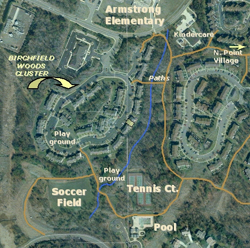
A current & interactive view can be seen by using Google Maps
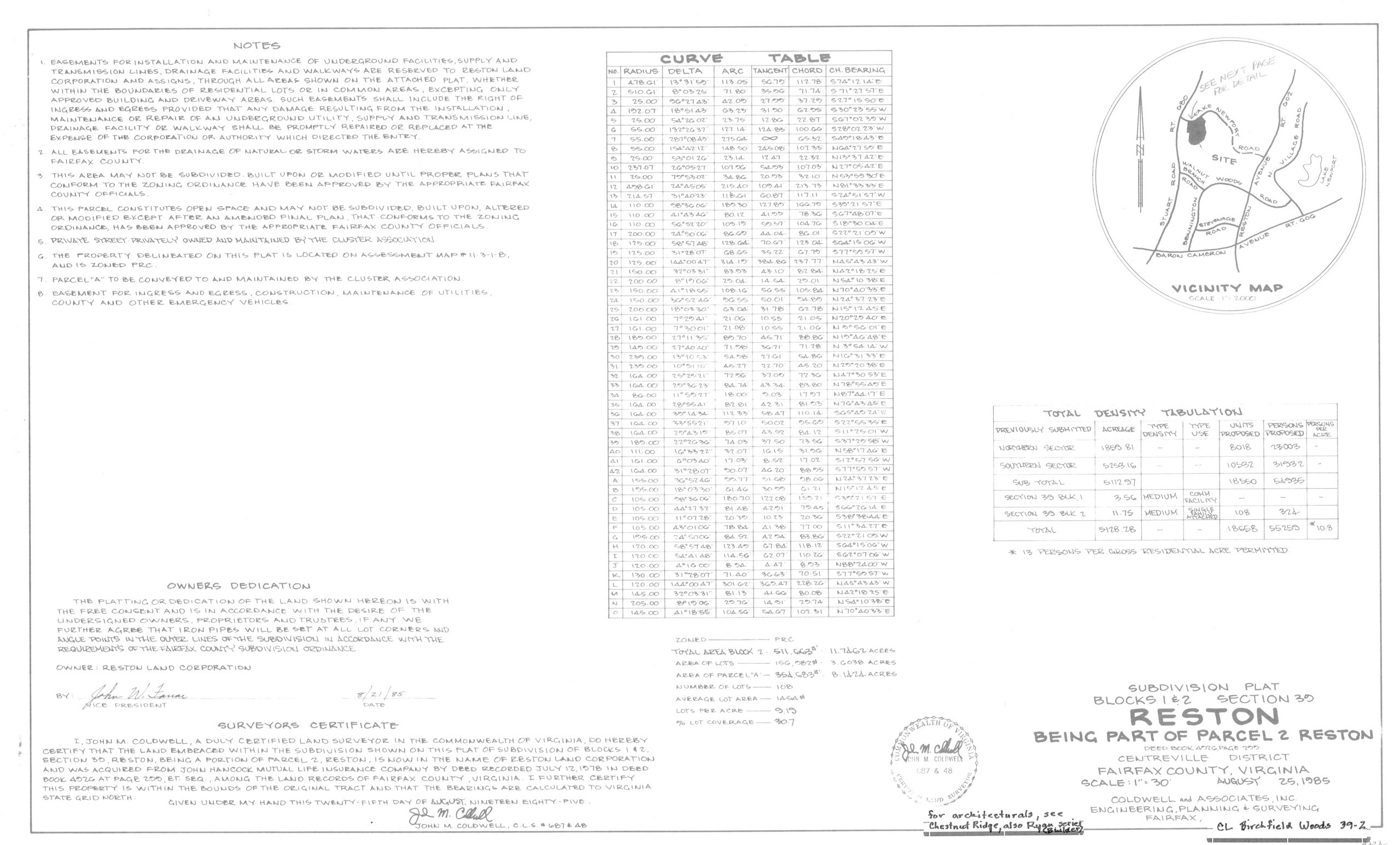
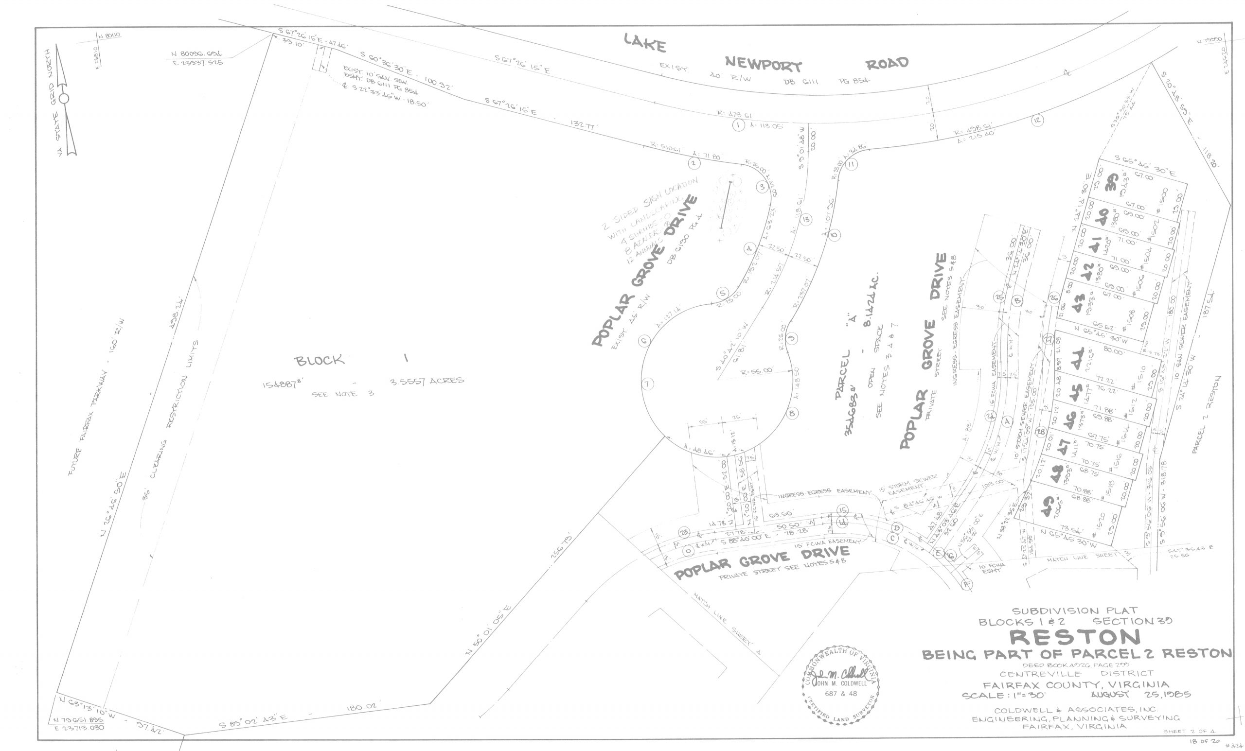
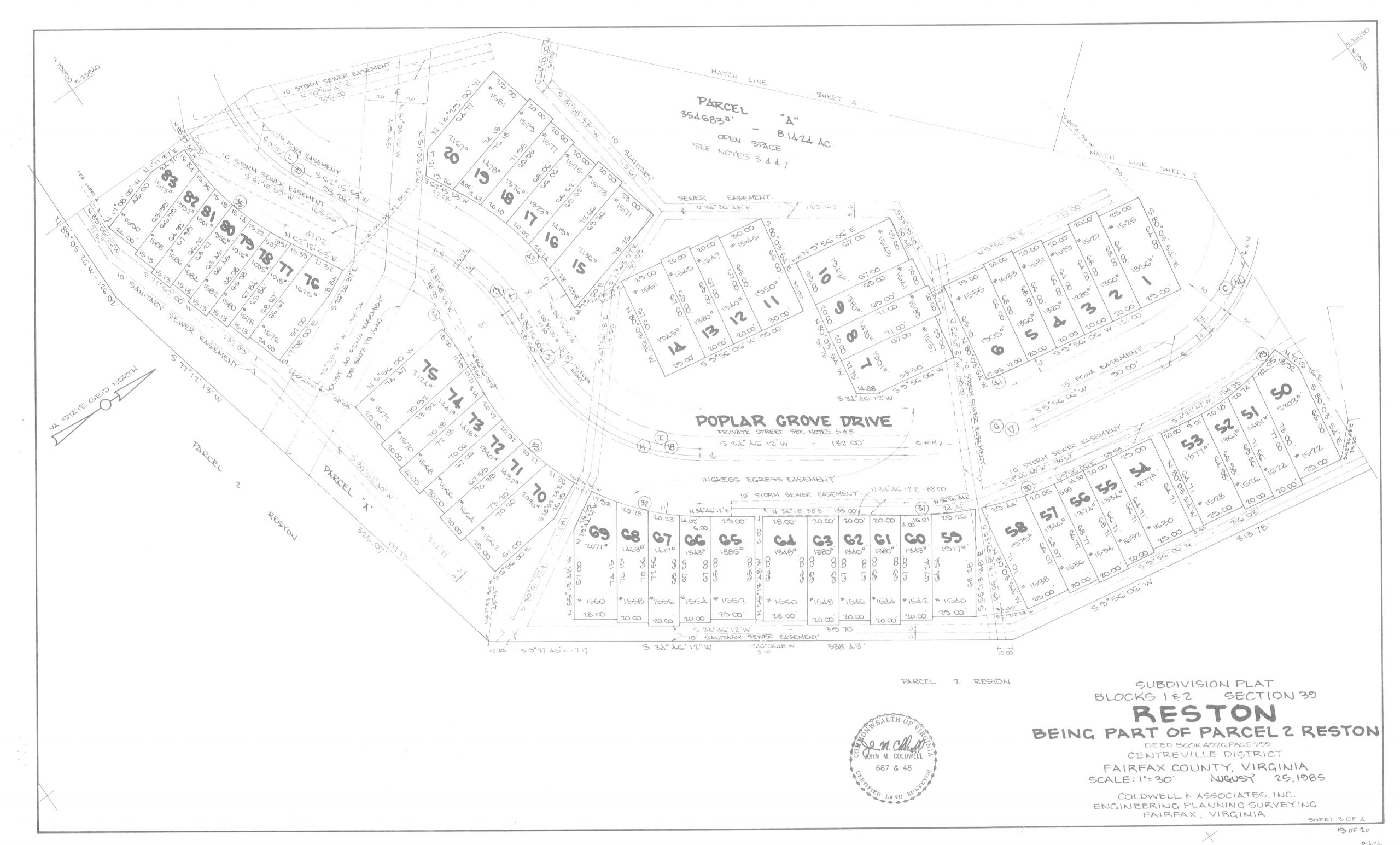
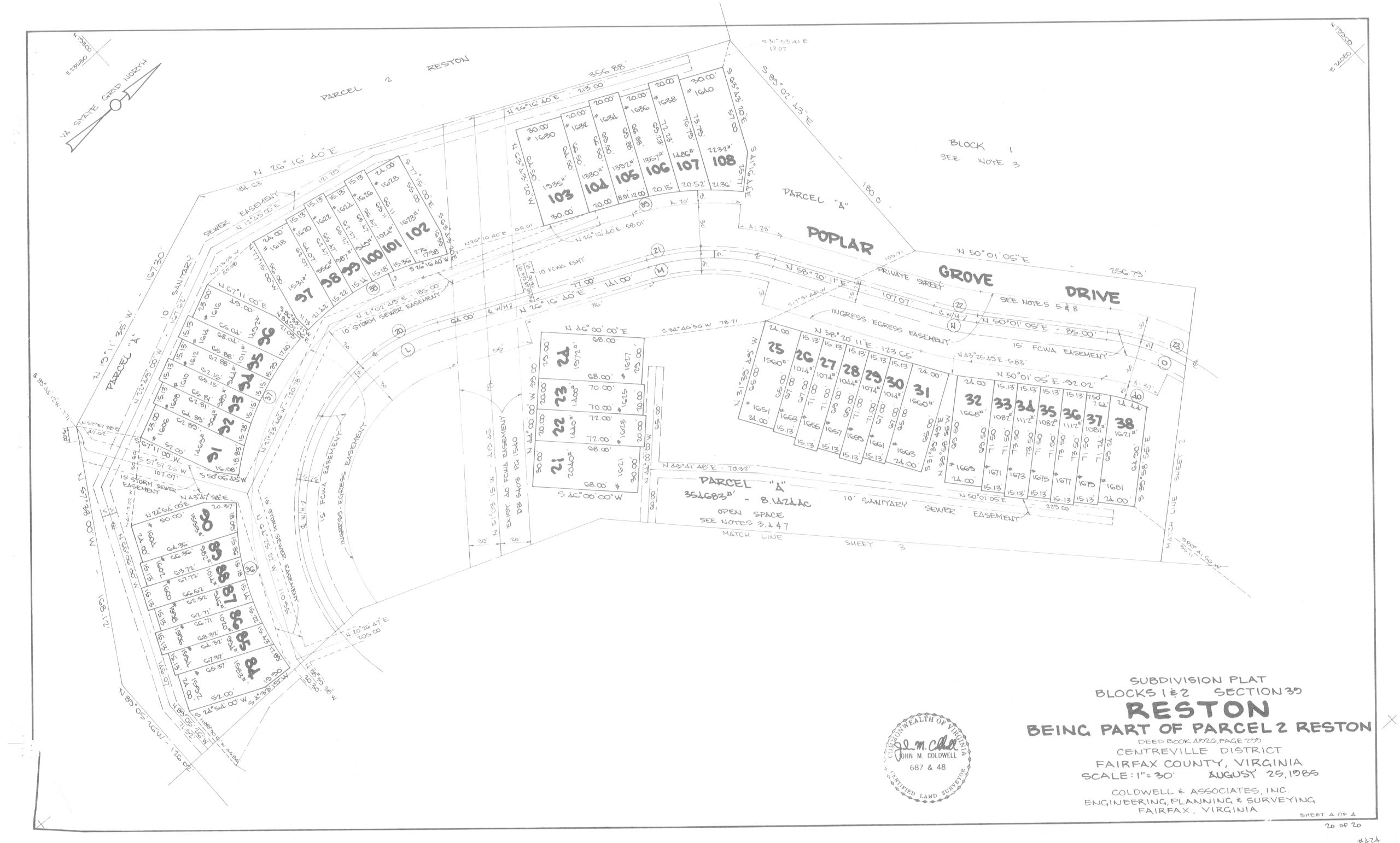
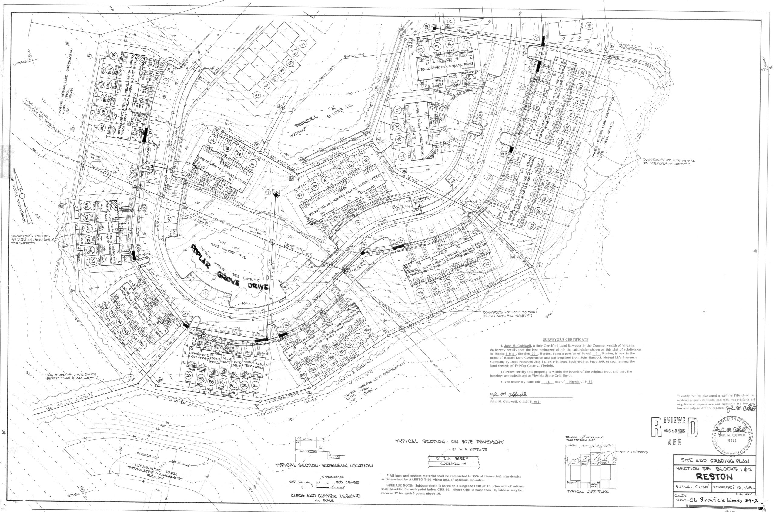
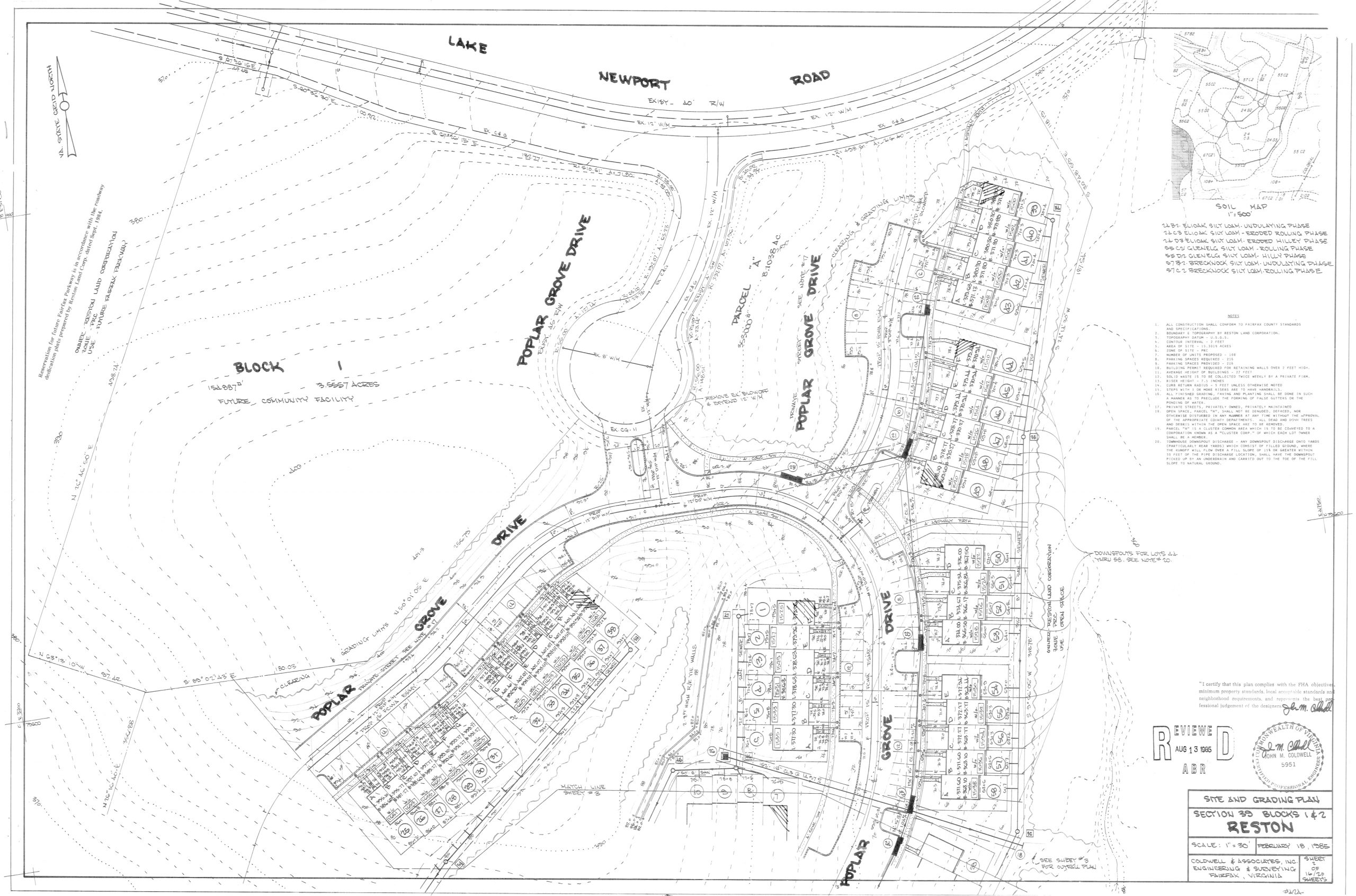
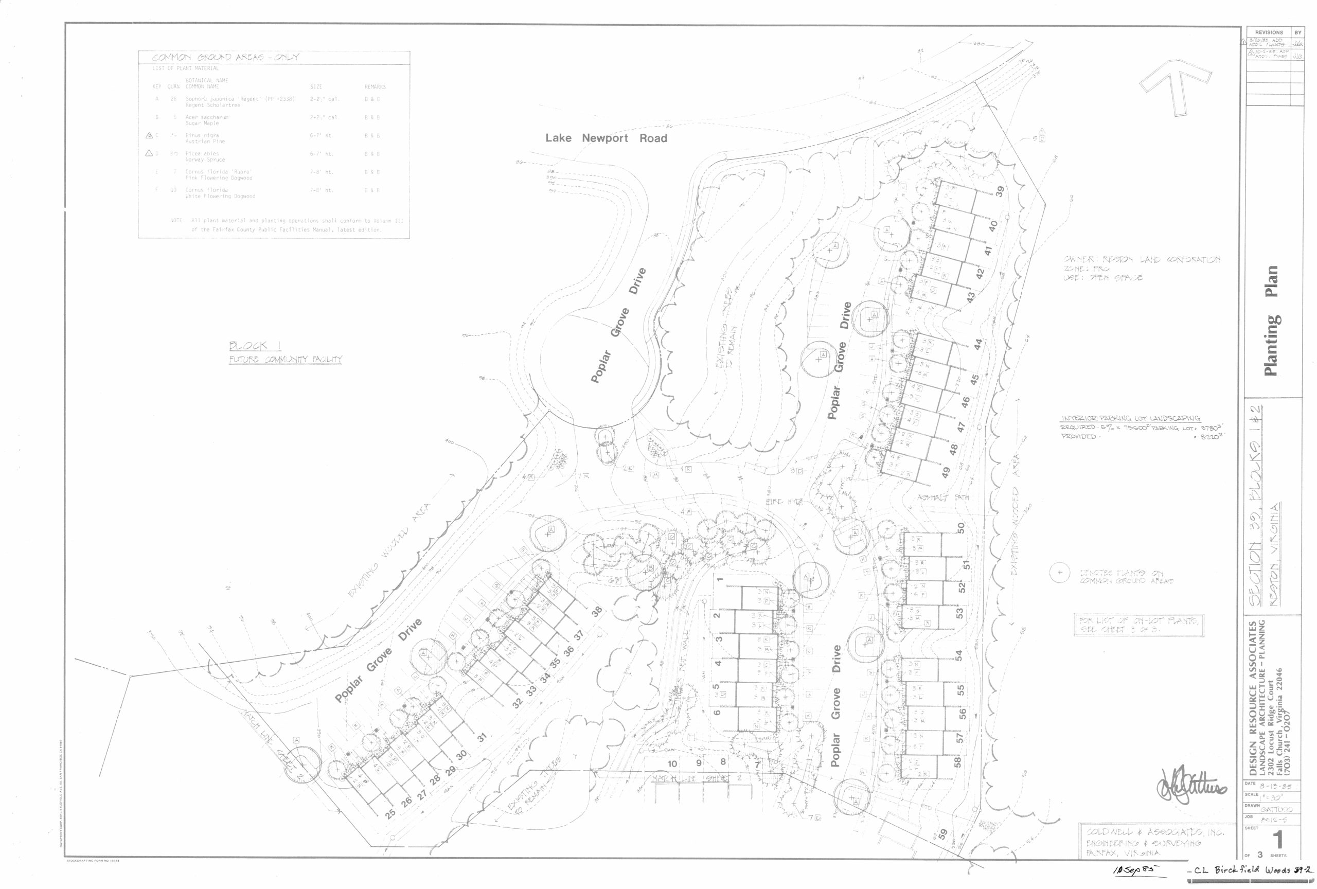
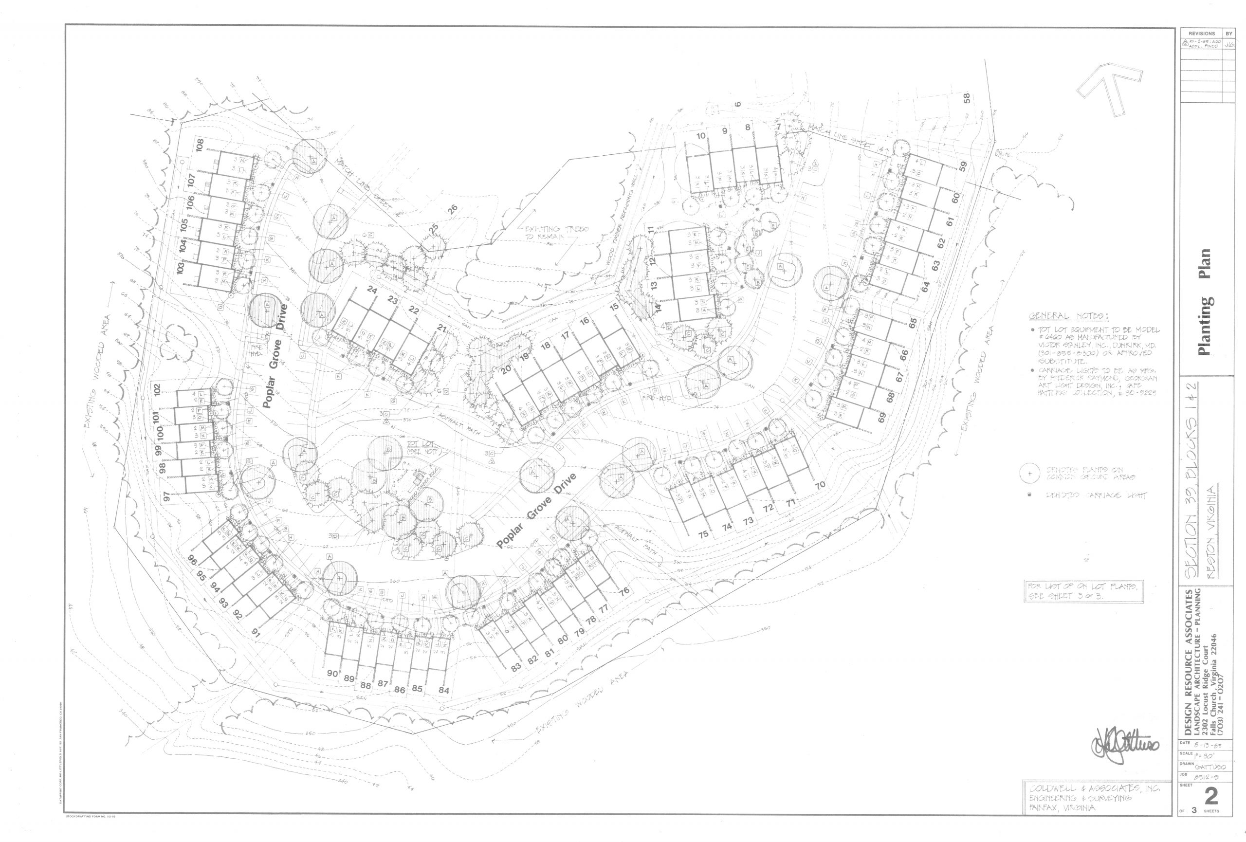
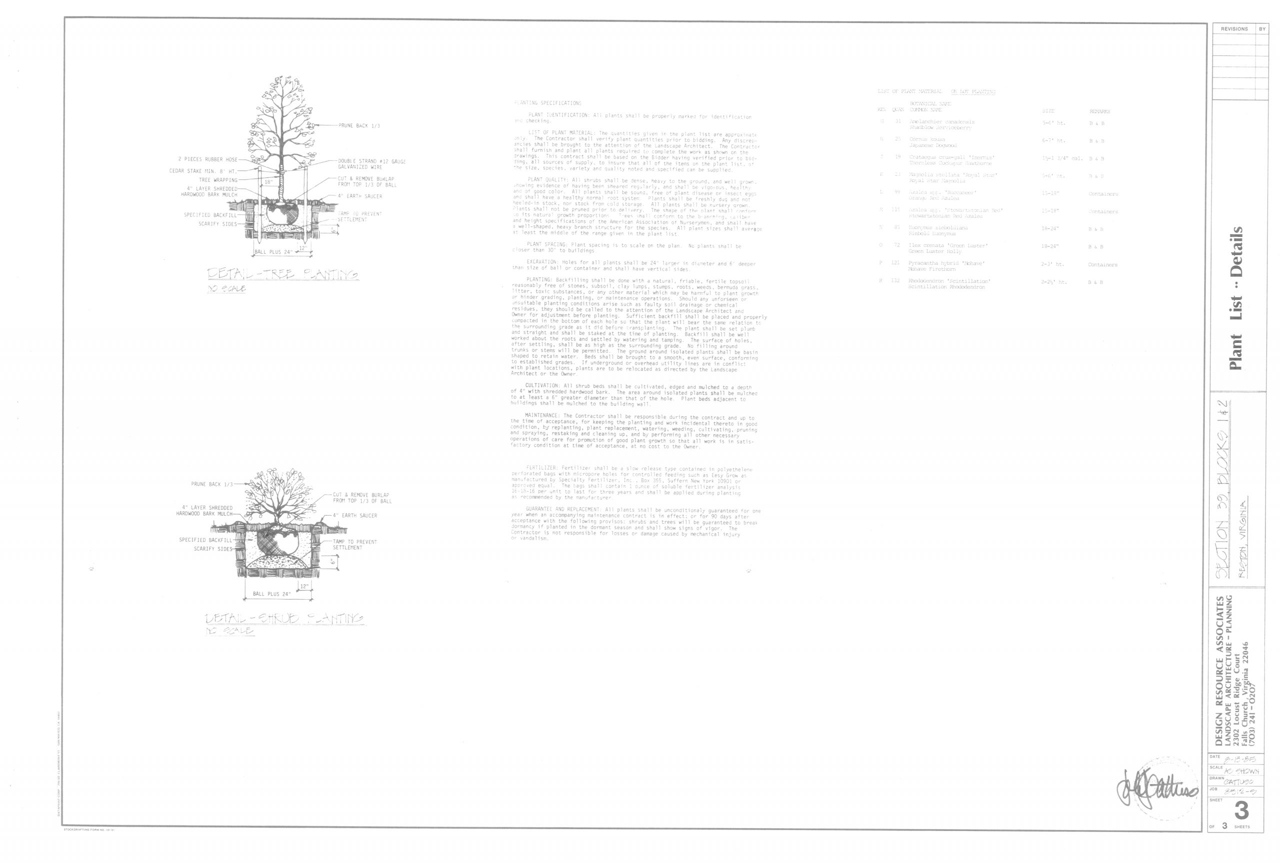
Neighborhood Drawings
These are the original drawings from 1985. For specific boundary line determinations, please consult a licensed surveyor or other qualified professional.
Subdivision Plat: page 1, page 2, page 3, page 4